Modern Vocabulary: GEOMATICS
What does this term mean?
Saturdays are perfect days for scientific surprises. Surprise—we’re talking about the history and etymology of geomatics today!
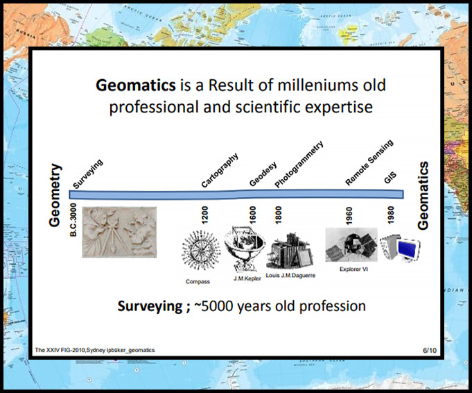
The study and use of geographic data has come a long way. Once humans advanced from caves and remedial huts to grander architectural endeavors, certain experts developed the technique of determining the terrestrial two-dimensional or three-dimensional positions of points and the distances and angles between them. This science, called surveying, is still a fundamental step in all mapping and construction.
BREAKDOWN: SUR- (over) + VEY- (see)
Of course, all that surveying data came in handy as explorers traveled and mapped the world. The science, art, or practice of making maps is called cartography.
BREAKDOWN: CART- (card, chart) + -GRAPHY (writing)
Attention to geographic and astronomical features inspired ancient thinkers to move from a flat Earth concept to a spherical one. The emerging science of measuring and representing the geometry, gravity, and spatial orientation of the Earth in temporally varying 3D is now called geodesy.
BREAKDOWN: GEO- (Earth) + DES- (divide) + -Y (act)
Geodesy may describe the science of measuring and representing geospatial information, but practical applications of that data fall under the heading of what was once called surveying engineering or geographic information science. These days, the transdisciplinary mixture of all surveying and mapping related sciences is usually called geoinformatics or, more concisely, geomatics.
BREAKDOWN: GEO- (Earth) + IN- (into) + FORM- (form) + ATE- (make) + -ICS (science or art)
Basically, geomatics can be seen as the art of science of making use of information about the Earth. Cool, no?
“I've always been fascinated by maps and cartography. A map tells you where you've been, where you are, and where you're going -- in a sense it's three tenses in one.” —Peter Greenaway


